Thursday, July 29, 2010

Mama Shasta and Mama Lassen's Volcanic Love: burning hearts of the pacific crest


listen to your mothers.
when I first rode along the Volcanic Legacy Scenic Byway, toward Mt Lassen in upper California, I could immediately feel the intense energy that still flows almost 100 years after Lassen's major eruption in May 1915. A week later, I take for granted the lava rock debris constantly under our feet, the holy igneous boulders we sit on that line the creeks. We are covered in red dust by day but under moonlight the same dusty hills become purple and magical. And from the pines that do stand here, hang mammoth cones and coalesce chunks of amber.

they are the southern saints. before Mt Saint Helens erupted in 1980, the most recent continental USA volcanic eruption was from Lassen. when you are here, imagine what your surroundings looked like just one hundred years ago, old-growth forest all around. let your hooves brush the ground. "a brief moment in the ancient battle between earth-shaping forces of creation and destruction." -nps.gov website
camping at the foot of lady lava lamp Lassen for three july nights, each day was scorching dry heat but as soon as the sun set this amazing breeze blew through, becoming more constant as the night went on. it is this mix of warm and cool, dry but green, that I can see why so many people have found comfort living among these volatile hills.

http://www.volcaniclegacybyway.org/
http://www.nps.gov/lavo/naturescience/eruption_lassen_peak.htm

Mount Shasta is even more majestic, a place so intensely powerful I barely can write about it! But John Muir was able to - after his first visit he said "my blood turned to wine and I have not been weary since." such is the praise which people have given this mountain, sacred to several indian tribes and a center for many more recently-arrived spiritual paths. A fellow traveler mentioned a visit where there was a band singing songs to the dormant volcano. it is said there is a city inside the mountain, Telos, and various accounts of visiting the Lumerian city of Telos can be found around the web.
she rises over 14000 feet, always snowcapped, regardless of the warm dry air below her. she is the second-highest volcano of all of the Cascades, and visible from sixty miles in almost all directions. in the evening light, her bare rock face turns a purple-grey tint as she looks down upon the Juniper Flats her long-ago eruptions helped create. Her most recent eruption was 200 years ago, on the north face (Military Pass) where we spent the most time.
in the town of Mt Shasta on the west ("front side"), which I said was like a Lhasa for the US, the city park holds the headwaters of the Sacramento River, main watersource for the north part of the Central Valley. water just flows out of the mountainside into a pool, where visitors fill water containers, bathe their faces and arms, meditate, discuss spiritual matters.
there was hardly enough time to go to Panther Meadows, the renowned gathering space and hiking area way up on the tree-line, that will be for next visit! and telos. but out there on the dusty "military pass" road on the north we saw enough.
giant shadows spread across adjacent mountain the Whaleback with no clouds or airplanes above. large animal tracks of different animals in the red dirt. and of course, tall pines and porous lava rock everywhere. amid that cool dry night breeze. the breeze of life. it was a blessing from Mama Shasta, a fitting end for this amazing trip, a wish and destiny fulfilled, to stand in the presence of such a powerful, awe-inspiring place, the image of many dreams, the "heart-chakra of the pacific crest," the destination of the Coyote.
I will visit you again, mothers.

various Mt Shasta webpages:
http://www.siskiyous.edu/shasta/fol/nat/henn.htm
http://www.sacred-destinations.com/usa/mount-shasta
http://www.stateparks.com/shasta.html
http://www.greatdreams.com/shasta.htm
Friday, July 23, 2010

Whiskeytown, CA

Whiskeytown National Recreation Area


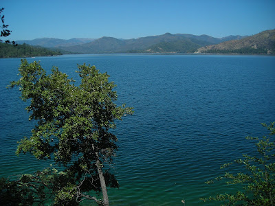
Whiskeytown Lake at the entrance of the Klamath Mountains, close to Redding, CA is a beautiful mountain lake!!


Whiskeytown Falls on Clear Creek, just west of the lake, is refreshing and cool in a land that is so dry...


from day into night, la luna climbs the evergreens

http://www.nps.gov/whis/

Thursday, July 22, 2010

Goodbye Anubis: the path of the prairie-dog (formerly platte river blues but got lost somewhere in Nevada)


from riding...from the raven...from the air, smoke and clouds.
I feel you. I must find you. though she tells me to beware, I don't care.
But it wasn't me you were looking for, it wasn't me nor will it ever be,
I said to the eye as I lay on the floor. your amethyst quetzal eyes.
you're looking for a man, a long feathered man, and you're delicately watching
as you were Set to do,
But the man you're looking for -
he's behind you.

The hawk that flew high above the waterfall carries a match in the edge of its jaw
fly to the smokestack of the factory where planes are built for war
to the furnace on the airport's 21st floor
fly with your amethyst eye
over wheatflields, cold and grey
oh child my child your smoke I see rising
you'll make it to the airforce base one day.

THE WEST

oh how it is to be a prairie-dog in the land of coyotes.
now out here, the coyote guides those who follow in the path of the prairie-dog.
back and forth through the evergreen desert and the volcanic hills.
and I could do this for ever, I don't really want to leave...
but it is not for a lack of living responsively, to live "keeping up with the coyote."

Sunday, July 18, 2010

Boulder Red Rocks: The Deer Up Here


The deer up here are different: stockier, longer legs, larger ears, smaller tails with no white - more like elk. The small-antlered doe was sitting cutely in a low area of the red rocks hillside. Are these "Red Deer?" Also these deer are more tolerant of people (well you're surrounded by animal lovers not rednecks and hunters, so....

Boulder Creek, Boulder Canyon: it only gets better


oh to reach a canyon in the Rockies without a car. By bus and on foot. Amazing! Boulder really does rock. Where is my caribou?
They call it Goat Rock. or Elephant Buttress. and the creek below has a spot called Jones' Hole where people play music and swim and picnic and watch rock climbers. The perfect spot really, to catch the breeze. But it still gets better. Climbing up the Rock the breeze becomes wind, flowerpetals fly through the air, the sun westward makes a halo with its golden glow and it was gold that urged the white man through this canyon. This is the Athens of the West and the Dahlonega of the Rockies, wrapped together in one. Denver pigeons give way to Boulder white-throated swifts.

...
carved into concrete on the Boulder Creek Bike Trail:
"Chief Niwot will get you and so will Jesus"

Thursday, July 15, 2010

CLEAR CREEK CANYON AND LOOKOUT MOUNTAIN PARK: Golden, CO


One evening, two new friends took me to the closest canyon and mountain park, just under 30 minutes from downtown Denver. One road goes down – following Clear Creek upstream into a long canyon, another goes way up – up Lookout Mountain to a park (which contains Buffalo Bill's gravesite, closed by the time we arrived). Two Lookout Mountains in two weeks! Lookout!
We watched the sun set from near the mountaintop, and it was awe-inspiring. And the wind blew me to the rocks near the edge, in the kindest way possible.

the sunset side, then the city side


for more about Lookout Mountain, go here


PLATTE RIVER BLUES: DENVER, CO


My first steps in Denver off the bus at Market St. station gave me chills, for a cold front had just come through, and wind and rain were moving in. I was to meet my friend at a cafe called Paris on the Platte, just across the South Platte River via the 16th St. Pedestrian Mall. The mall has this amazing free shuttle bus, running every few moments the mall's length from the river to the Broadway/Colfax intersection. At this part of the river, where it meets Cherry Creek, the city has preserved a long series of parks, with walking trails and historical markers, stone patios, and a rocky shoal (presumably not natural). This continues to be my favorite spot in the city, I'll sit here regardless of the wind and rain, for I like the freshwater smell here and I feel peace. A woman and a girl toss stones behind me into the still-polluted river and see shells on the shore. Birds of all kinds fly around me.
This was once the home of Southern Arapahoe peace chief Little Raven (Young Crow), who once welcomed the west-bound white settlers with gold in their eyes: “Take the gold! Just don't stay long.” His story is told at the park, on the Platte's south bank. Take the young crow by his song, I'll sit here in the rain but I can't stay long.

Wednesday, July 14, 2010

Lookout! singing in crystal canyons is singing in cathedrals

Lookout Mountain again: Cloudland Canyon – there are caverns beneath with lakes!

Cloudland, near Chattanooga yet in Georgia, is really the gem of Lookout Mountain, so beautiful I keep coming back every time I'm nearby. This time, we descended to the second falls then again to a third one deep into the canyon, and by this time we were singing and drumming the rails on the way down! Each waterfall has its own personality: The first, our gulf golden-child that gets the attention it deserves;


the second one tall, distant, secretive – doesn't realize its own beauty!

The third (and last, as far as we know) forgotten, smaller, dark, and deep. Yet totally cool.
And then there are would-have been falls in between, where instead of water cascading down the surface, it drips deep inside the rock, you can see it if you're careful to look.

the Nashville Basin, Bells Bend on the Cumberland.

Camping at Sulphur Creek farm under full moon for my brother's birthday.
Eating copious amounts of Squash and Dinosaur Kale, going to sleep with frogs and waking up with cows!

West of Nashville, following the Cumberland (which has recovered pretty well from the May 1 flood), rolling hills increase gradually. Only a few miles away, yet feels deep in the country. And the farmers of Bells Bend feel it should stay that way, having via literal Grass Roots movement, kept developers away. There is a city park at Bells Bend too, including a nature center.
At the town of Ashland City, 12 miles beyond, we found a more placid swimming hole in Little Marrowbone Creek. Again, sweltering June sun makes natural baths such a necessary idea!!

SAVAGE GULF STATE NATURAL AREA – BEERSHEBA SPRINGS, TENNESSEE


Savage Gulf and other gulfs, midsummer with the faeries and country legends on the plateau, “living proof” of sharks...or muskies! Bodysurfin' the Appalachians, swimmin' holes and movin' stars.

It began at Stone Door Camping Area, where we arrived just before sunset, enough time to set up our tent and walk over to small Laurel Falls behind the ranger office. I had been to Cumberland Plateau before, knowing in advance about the gulfs, the bowl-shaped pools at the bottom of waterfalls, that almost define this area of Tennessee. Contrast this with the sharp cliffs of the Blue Ridge (see “go forth into the waterfall”) and how these falls are more kind to swimmers and divers.


greeter falls


There are several gulfs, falls, and sinks spread across the park, a huge area of the west face of the Plateau, but Greeter Falls is the most well-known to locals since it's so easily reachable from its parking lot. By the time we reached the lower falls next morning, it was already hot and a group of teenage boys were swimming and diving. Nature's bath, clear and so cold! Since the boys were so loud, some fish swam to us as we bathed in the sunlight.

The campground? Remote and dark yet not far from the parking lot, with pit toilets close and flush toilets still not too far. And fire pits with plenty of already-cut wood around, perfect for sister fire-breather to keep a healthy flame for hours while white-tailed songs we played into the late night. The wood turned out filled with termites, though, suffering for our solstice fun as they were engulfed in the flames.


Fun Fact: The park's Stone Door rock was used for a climactic moment in the film “Living Proof” about Hank Williams, Jr.

If you go, camping is free on all parts of the park but requires a permit. Also, it is said that many poisonous snakes (rattlesnakes, copperheads) call the park home, but we didn't find any.

for more about Savage Gulf:
http://www.tennessee.gov/environment/na/natareas/savage/