Showing posts with label park. Show all posts

Friday, September 20, 2013

The Softground CA FAE Floats around the Bay (Questing, Part 1)


San Francisco, California Full Harvest Moon 2013

from the hilltop looking north


Floating around Northern California is easy and difficult at once. As with the sea breeze, It's easy if you find a flow and keep moving but one feels resistance when stopping for more than a moment.  The hills block the breeze and also horizontal development, which really is a good thing when you've been in the more open desert.

There has been a call to spend more time in California, this time to look for a place to settle next. San Francisco is known for its strong queer, BDSM, and traveler communities. Why haven't I been able to find them thus far? Well, maybe because everyone, like me, is constantly moving...that's what travelers do, at least.   So, here I am, the Queen of Shadows, in temporary exile from the Sonoran Desert, on a quest in a dangerous magickal land less like Pixie Hollow (that's in So Cal) and more like Middle Earth.

Electronic dance music plays over the speakers of the kinky coffeehouse where I sit and write, the sun setting behind me leaving me wondering what wraiths might lurk outside tonight.  The energy here is good and black-clad folk of all genders fill the seats as the City's famous Folsom Street Fair comes in about a week. Plus, it's a full moon and several other events are happening around town, so it's a busy time of year for San Francisco.
I found this out last night when seeking  an "Inn" for sleep on short notice, and almost all of the local hostels are fully booked on a weeknight. (There are no hostels listed online for the East Bay or Santa Clara county).  The only one who had room for me was the Pacific Tradewinds Hostel on Sacramento St.  As it turns out, the Tradewinds is a pretty awesome place, perched on the 4th floor of a thin building a couple of blocks from Chinatown.


It's compact but the communal space
doorway to the hostel on the street
- kitchen and sitting area in one room
as you enter - makes folks interact with each other immediately. And, communing with other travelers is a major reason folks stay in hostels. Quickly, I met a couple of women and we shared our travel stories and so it happens that one of them is from the state where I grew up. The dorm rooms are small and I slept soundly, waking up for coffee and more travel networking. It's not a party hostel or a flophouse, but everyone there was open, friendly, and helpful. They offer you a glass of water as soon as you arrive, knowing you just climbed a hill and a few flights of stairs.

the Chinese Benevolent Association building in Chinatown
Today was warm and sunny, a treat for the city usually draped in fog, and so there were few ring-wraiths or spooks to be found wandering the streets.  A walk down Folsom St. to Rainbow Grocery ignited major kim chee cravings which would repel any vampires if they came  around.  The energy from the Mission Dolores was beaming, and a visit to my favorite power spot in the City gave my companions and I a needed charge.
the stained glass image for the Soledad Mission inside
the Mission Dolores Basilica
The stained-glass saints and stone statues in the trees gave solace and comfort in our directionlessness. Saint Inez looks me directly in the eye and gives me strength of spirit. Senora de la Soledad demonstrates the ability to concentrate in her solitude.


Back in the Coffeehouse I am distracted by a mix of conversations:
--"I did not raise you in this house to ask questions."
--"Are you going to see Daniel Ash?"

 Outside, it is cool, and the breeze blows strong. Feet stomp on the wood floors of Wicked Grounds where there is very little wickedness and lots of fae folk networking with humanfolk for the street fair and other events. I'llreturn here soon.  My quest leads me to the magickal forest, especially with the moon full and the equinox coming. Like the sea breeze, I must keep moving with the flow and find that pass through the hills.

Pacific Tradewinds Backpacker Hostel
www.san-francisco-hostel.com
680 Sacramento St  San Francisco, CA 94111

(415) 433-7970

Rainbow Grocery
www.rainbow.coop

1745 Folsom St  San Francisco, CA 94103
(415) 863-0620

Wicked Grounds Coffee
www.wickedgrounds.com
289 8th St  San Francisco, CA 
94103

(415) 503-0405

Mission Dolores is at 16th St. and Dolores St.
www.missiondolores.org


Thursday, October 28, 2010

There is nothing more Portland than Mount Tabor, boom, boom


....and left this fertile land....

When the rains come and you're feeling down in the Rosy City, nothing quite compares to a visit to Mount Tabor. This is the Portland I remember, the fir smell, the air, one climb and it all came back. The old volcano is a temple of peace in this city, no other city I've been to has anything like it. The ancient fire within warms your heart, others in the park notice it too, it's a little like on Shasta but uniquely itself in its easy reachability. Several buslines take you there, the 14, 15, and 4 at least all go near, and if you have a car you can drive up at least part of the way. Need a break from hipsters on Hawthorne? Look east and up.

"Clackamas, paws, boom boom" beats the heart of the volcano maiden


To the west look down at the city, to the east look out at Hana, Mount Hood
Sister of Tabor
Hana stands clear with glowing white hair
a little pink in the setting sun
her sister called and said come see me
so now I am here and today the sky's clear
so I could walk cross the evergreen branch and go and see Her too
"It's cold up here," She says, "are you prepared?
And storms come quick so leave if you're scared."
Then the wind whistled and all I could see
was millions of Firs putting hands out for me
Timberline, she died here and her ashes were spread
falling like rain on Hana's white head
On adventurous days, she says, her hair turns pink
come next sunny day and I'll get you a drink (spring)
oh Hana oh Hana we sit and watch you from Tabor's green hall in the fall
and down will come baby, Craters and all

hoods like hana
craters and all

Thursday, July 29, 2010

Mama Shasta and Mama Lassen's Volcanic Love: burning hearts of the pacific crest


listen to your mothers.
when I first rode along the Volcanic Legacy Scenic Byway, toward Mt Lassen in upper California, I could immediately feel the intense energy that still flows almost 100 years after Lassen's major eruption in May 1915. A week later, I take for granted the lava rock debris constantly under our feet, the holy igneous boulders we sit on that line the creeks. We are covered in red dust by day but under moonlight the same dusty hills become purple and magical. And from the pines that do stand here, hang mammoth cones and coalesce chunks of amber.

they are the southern saints. before Mt Saint Helens erupted in 1980, the most recent continental USA volcanic eruption was from Lassen. when you are here, imagine what your surroundings looked like just one hundred years ago, old-growth forest all around. let your hooves brush the ground. "a brief moment in the ancient battle between earth-shaping forces of creation and destruction." -nps.gov website
camping at the foot of lady lava lamp Lassen for three july nights, each day was scorching dry heat but as soon as the sun set this amazing breeze blew through, becoming more constant as the night went on. it is this mix of warm and cool, dry but green, that I can see why so many people have found comfort living among these volatile hills.

http://www.volcaniclegacybyway.org/
http://www.nps.gov/lavo/naturescience/eruption_lassen_peak.htm

Mount Shasta is even more majestic, a place so intensely powerful I barely can write about it! But John Muir was able to - after his first visit he said "my blood turned to wine and I have not been weary since." such is the praise which people have given this mountain, sacred to several indian tribes and a center for many more recently-arrived spiritual paths. A fellow traveler mentioned a visit where there was a band singing songs to the dormant volcano. it is said there is a city inside the mountain, Telos, and various accounts of visiting the Lumerian city of Telos can be found around the web.
she rises over 14000 feet, always snowcapped, regardless of the warm dry air below her. she is the second-highest volcano of all of the Cascades, and visible from sixty miles in almost all directions. in the evening light, her bare rock face turns a purple-grey tint as she looks down upon the Juniper Flats her long-ago eruptions helped create. Her most recent eruption was 200 years ago, on the north face (Military Pass) where we spent the most time.
in the town of Mt Shasta on the west ("front side"), which I said was like a Lhasa for the US, the city park holds the headwaters of the Sacramento River, main watersource for the north part of the Central Valley. water just flows out of the mountainside into a pool, where visitors fill water containers, bathe their faces and arms, meditate, discuss spiritual matters.
there was hardly enough time to go to Panther Meadows, the renowned gathering space and hiking area way up on the tree-line, that will be for next visit! and telos. but out there on the dusty "military pass" road on the north we saw enough.
giant shadows spread across adjacent mountain the Whaleback with no clouds or airplanes above. large animal tracks of different animals in the red dirt. and of course, tall pines and porous lava rock everywhere. amid that cool dry night breeze. the breeze of life. it was a blessing from Mama Shasta, a fitting end for this amazing trip, a wish and destiny fulfilled, to stand in the presence of such a powerful, awe-inspiring place, the image of many dreams, the "heart-chakra of the pacific crest," the destination of the Coyote.
I will visit you again, mothers.

various Mt Shasta webpages:
http://www.siskiyous.edu/shasta/fol/nat/henn.htm
http://www.sacred-destinations.com/usa/mount-shasta
http://www.stateparks.com/shasta.html
http://www.greatdreams.com/shasta.htm

Thursday, July 15, 2010

PLATTE RIVER BLUES: DENVER, CO


My first steps in Denver off the bus at Market St. station gave me chills, for a cold front had just come through, and wind and rain were moving in. I was to meet my friend at a cafe called Paris on the Platte, just across the South Platte River via the 16th St. Pedestrian Mall. The mall has this amazing free shuttle bus, running every few moments the mall's length from the river to the Broadway/Colfax intersection. At this part of the river, where it meets Cherry Creek, the city has preserved a long series of parks, with walking trails and historical markers, stone patios, and a rocky shoal (presumably not natural). This continues to be my favorite spot in the city, I'll sit here regardless of the wind and rain, for I like the freshwater smell here and I feel peace. A woman and a girl toss stones behind me into the still-polluted river and see shells on the shore. Birds of all kinds fly around me.
This was once the home of Southern Arapahoe peace chief Little Raven (Young Crow), who once welcomed the west-bound white settlers with gold in their eyes: “Take the gold! Just don't stay long.” His story is told at the park, on the Platte's south bank. Take the young crow by his song, I'll sit here in the rain but I can't stay long.

Wednesday, July 14, 2010

SAVAGE GULF STATE NATURAL AREA – BEERSHEBA SPRINGS, TENNESSEE


Savage Gulf and other gulfs, midsummer with the faeries and country legends on the plateau, “living proof” of sharks...or muskies! Bodysurfin' the Appalachians, swimmin' holes and movin' stars.

It began at Stone Door Camping Area, where we arrived just before sunset, enough time to set up our tent and walk over to small Laurel Falls behind the ranger office. I had been to Cumberland Plateau before, knowing in advance about the gulfs, the bowl-shaped pools at the bottom of waterfalls, that almost define this area of Tennessee. Contrast this with the sharp cliffs of the Blue Ridge (see “go forth into the waterfall”) and how these falls are more kind to swimmers and divers.


greeter falls


There are several gulfs, falls, and sinks spread across the park, a huge area of the west face of the Plateau, but Greeter Falls is the most well-known to locals since it's so easily reachable from its parking lot. By the time we reached the lower falls next morning, it was already hot and a group of teenage boys were swimming and diving. Nature's bath, clear and so cold! Since the boys were so loud, some fish swam to us as we bathed in the sunlight.

The campground? Remote and dark yet not far from the parking lot, with pit toilets close and flush toilets still not too far. And fire pits with plenty of already-cut wood around, perfect for sister fire-breather to keep a healthy flame for hours while white-tailed songs we played into the late night. The wood turned out filled with termites, though, suffering for our solstice fun as they were engulfed in the flames.


Fun Fact: The park's Stone Door rock was used for a climactic moment in the film “Living Proof” about Hank Williams, Jr.

If you go, camping is free on all parts of the park but requires a permit. Also, it is said that many poisonous snakes (rattlesnakes, copperheads) call the park home, but we didn't find any.

for more about Savage Gulf:
http://www.tennessee.gov/environment/na/natareas/savage/


Monday, May 17, 2010

High Falls and Indian Springs: The Fall Line in middle Georgia


Work has been so tiring lately. Especially when it's getting warm in the afternoons and you're sent out on difficult missions in strange locations that aren't so welcoming. And if you want some shade and shelter from south metro Atlanta I-75 suburbia, there actually aren't many natural public spaces to choose from. However, just about halfway between Atlanta and Macon, there is a lush section along the fall line escarpment (an ancient coastline) which has two state parks, High Falls and Indian Springs. Both are within a few miles of the interstate, and have been visited/settled for hundreds of years.

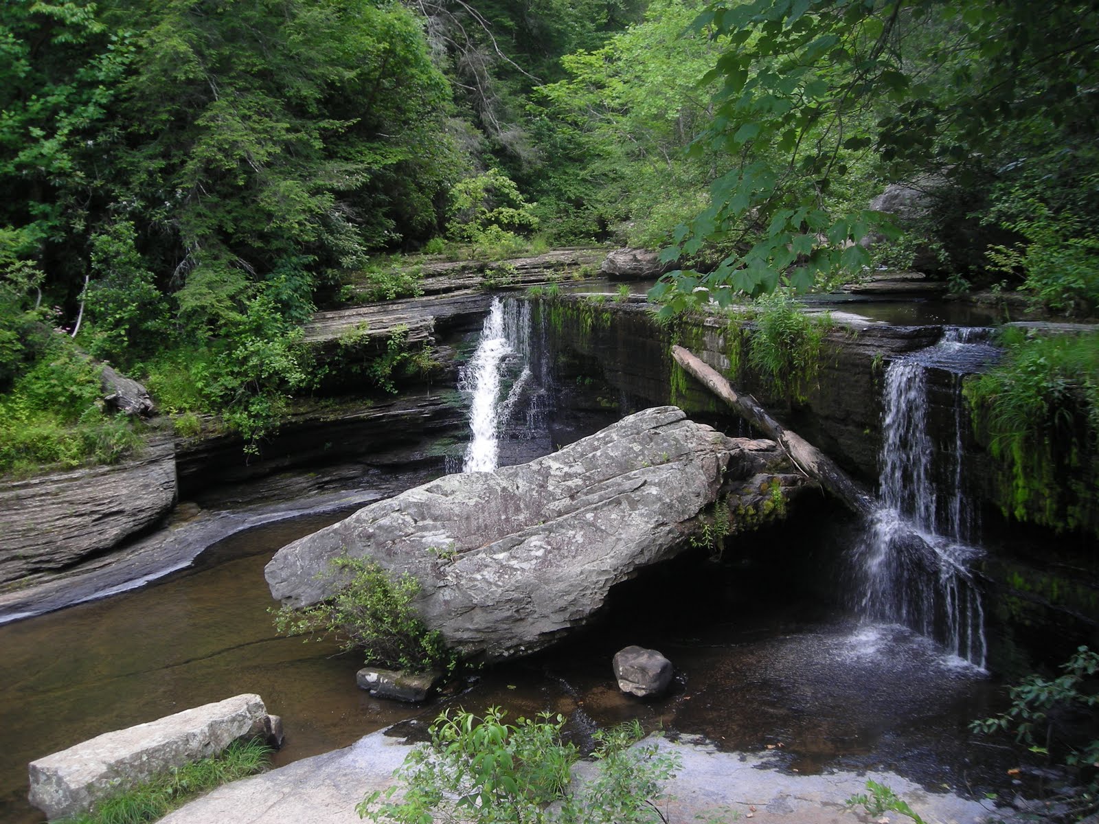
The High Falls on the Towaliga River

It was an industrial town in the 1800's, a perfect location for a grist mill. Before that, it was a Creek Indian settlement. The Towaliga rises in Henry County and is mostly flat until the falls, and then it joins the Ocmulgee River just north of Macon. The elevation change is sudden and intense, and separates the upper and lower Piedmont right here. Below the falls, canoeing/kayaking are popular, one of the few locations in middle Georgia.
I arrived not long before sunset, finding the cool spray of the falls totally necessary to counter the humidity of a warm season in the Georgia piedmont. (pictured at top) Then below the falls a little hiding space on the river's edge, with lots of rabbits and other wildlife running past me really made me want to stay.


http://www.gastateparks.org/HighFall

INDIAN SPRINGS

A little further from I-75 is middle Georgia's "Indian Springs," which was also a Creek settlement, then incorporated as a town by the whites, and the land around the spring and the two streams that also join there was bought by the state in 1825 as Georgia's original state park. Recognizing the importance of preserving the spring, the state has resisted offers from private companies to sell the land (for bottling/selling water, for example) because of its renowned healing properties (similar to other cases around the world of the known healing properties of spring water, and the rise and fall of the health resort industry boom in the 20th century).


The Spring House - built by the CCC in the 1930's

The first person to capitalize on the springs' resort potential, ironically, was Creek Chief William McIntosh (the park's lake is named after him). He signed two fateful Treaties of Indian Springs here with the Georgia government; the first in 1821 gave him property of this land, where he built his second plantation and a hotel. It must not have been good enough, because in 1825, he caved in to the whites' quest for the land and signed the second treaty, giving these springs, the Towaliga river and falls, the Ocmulgee basin/Macon, and the area that would become the city of Atlanta (up to the Chattahoochee), including the very spot I am sitting in right now writing this.

I was almost out of water when I arrived at the park, and there were several travelers from Macon and Atlanta who regularly come here with empty jugs and take advantage of the forever free flowing fresh water. The water smells so good here, it smells like life. Not like a truckstop sink or cooler, or surrounded by a ritzy resort.
Thank you, state of Georgia, for preserving this spot!

http://www.gastateparks.org/IndianSprings

Sunday, April 4, 2010

Dark Days at Black Rock (Spring in highplaces part 2)


BLACK ROCK MOUNTAIN STATE PARK
Mountain City, GA...the highest (elevation) park in GA.
It was cloudy, late, and rainy. You could barely see the mountain through the fog. Not really exploring weather!
But the Spring House amid the rhododendron - you can see the rhododendron begin in thick washes as you go up the mountain - here was a spot of peace that you could drink, and Trahlyta would have liked it here even though it isn't big enough for bathing...

Tuesday, March 23, 2010

New Echota brings the spring


I celebrated this year's spring equinox with photographer Chuck Smith at New Echota State Historic Site (Georgia). It was a stunningly beautiful day to spend in such an eternal, peaceful place.

A few trees in the park have begun to flower, this one by the "middle-class" Cherokee homestead circa 1828, the same one I am standing next to in the first photo.


Beneath the pine, a turquoise sun, a cloud of calm...
the necklace I made with an orange heart charm from Jumping Mouse Beads in Ellijay, just up the Coosawattee River from here


In the print shop, Chelsea shares a copy of page one of the February 21 issue of the Cherokee Phoenix she just printed, then explains that it's from 1828, not a month ago! (This was the first issue of the first Indian newspaper of any Nation, and was printed in English and Cherokee and edited by Elias Boudinot. It is still in existence.)


Looking up at a picture of Rising Fawn George Lowrey in the Council House. (In 1828 he was the Assistant Principal Chief of the Cherokee Nation, next under John Ross, photo beside him on right)


A piney forest behind the site is a fine place for a fawn, so get on your hooves and come on out!

For more information about New Echota: http://www.gastateparks.org/Echota

For more on the Cherokee Phoenix: http://www.cherokeephoenix.org/

All photography by Chuck Smith (GA Aviation Photography) 2010
Special thanks to Chelsea, David, Yvey, and Will at New Echota.

To the season!

Tuesday, March 9, 2010

from a Broken Bridge, Sweetwater has never seemed sweeter


I've been thinking about ruins lately...
A trip to Sweetwater Creek State Park on the cusp of spring, a tear drop shed as I entered for hearing that amazing sound of rushing water not fifteen minutes from
my home. And though it's warm, the trees are still bare, so there are so many clear views of the river all along.
The trail to the mill is well-traveled, so this time I chose to walk upstream, in solitude except for occasional joggers and dogs fo
llowed by tag-along men. I'd heard people talk about a bridge here, but I didn't see one, surprising given the lack of leaves. Then around a bend and under a mess of debris and fallen trees:


"It was September's flood that broke this bridge...
the hard work of 15 years by the Army Corps of Engineers!
a mass of green steel beams torn and thrown into the stream.
no human touch, only the hand of nature."
A jogger tells me this as he passes the ruin for the first time. It's going to change his route, he was expecting to cross as many others do.
Who would have thought, from a creek so Sweet, renewing itself again?

This could be a microcosm of the experience for those who lived through Hurricane Katrina, like my friend from Mississippi with whom I shared this story.

I sat on the concrete ledge which once was the bridge for a while, then as the sun was going down I walked down to the Mill area. Later in the day it's not so crowded and the rushing water over the shoals make for the best river experience
in metro Atlanta! There is some boardwalk and trail damage too, down here, where volunteers have been working to clean some of this up.
Here's a beautiful view of the river through the mill you can only see when the trees are bare:


I love this park and I will come here again as soon as I can!

For more information about Sweetwater, check out http://www.gastateparks.org/Sweetwater


Saturday, February 13, 2010

Winter Update 1: Occoneechi Mountain State Natural Area, NC


While passing through central North Carolina (my home state) I wanted to stop and visit one of the newer state natural areas, one that had been designated since I lived there. Occoneechi "Mountain" on the headwaters of the Eno River, once a Saponi settlement and only 867 feet in altitude - but still the highest point along the I-85 corridor and eastward to the coast - is easy to find, tranquil, and beautiful on a cloudy winter afternoon.

Near the summit is a circle of stones, the best spot to view the northward valley when the trees are leafless. I met an interesting woman there. It was so peaceful and the almost-melted snow spotted across the whole monadnock. If you walk up the main summit trail, look to your right just before the old firetower!
Occoneechi Mountain is located just off of I-85 at the S. Churton St. exit, near Hillsborough, NC. For more information....visit http://www.ncparks.gov/Visit/parks/ocmo/main.php


Tuesday, September 22, 2009

A Turn to Tennessee, A Fiery Gizzard in the Rain

Imagine being the first autumn leaf at the bottom of these falls.


ttttennesssseee parks I visited last weekend, for the second time - Red Clay Council Ground in April was the first, the last gathering place for the Cherokee before the Trail of Tears was begun - and it was raining but that didn't stop me. I was standing in North Chickamauga River in a gorge with fog covering the peaks above and the water was warm.


Faith is a flat-iron in the valley rain. Hope is a blow dryer.
Loneliness is a soggy daisy in Soddy-Daisy. And contentment is this spider on its riverside rock.


After this I was led up Monteagle Mountain, the truckers' favorite hill to hate, and at the top a mountain man suggested this white-dressed witchy woman wander to Grundy Forest and the Fiery Gizzard. One of the South Cumberland Plateau State Parks between Chattanooga and Nashville, on Scenic Hwy 41, it was like a mist tent going down the trail to the creek but I wasn't the only one out here in the rain.


Some waterfalls.....
Dog Hole (or Blue Hole)


School Run


Foster Falls


and thennn....