Showing posts with label waterfall. Show all posts

Monday, September 6, 2010

that sweet sweet emerald Chipola: Marianna, FL (Green)


Last year when touring Florida's natural springs, I just barely mentioned the Chipola River, going underground on the escarpment in Florida Caverns State Park. Well, we come to find out it is fed by almost 65 springs, from its initial rise on the Alabama/Florida border through Marianna, its emerald-toned water and holy limestone banks winding along, often only a mile from civilization but feeling far removed from it. Spring Creek (aka Jackson Blue Springs) is its largest tributary, and it contains several springs, mostly only accessible via water travel.
You can get in at Spring Creek county (Jackson) Park off US-90 just outside of town, by the Chipola Greenway from a dirt road off FL-73 between downtown and the bridge over I-10, or one of several boat landings upstream or downstream from these. The upper Chipola feels oh so magical, sweet, and pure! but closer to the Dead Lakes and its swampy merges with the Apalachicola it turns into a "regular" dark coastal river.

Wednesday, July 14, 2010

Lookout! singing in crystal canyons is singing in cathedrals

Lookout Mountain again: Cloudland Canyon – there are caverns beneath with lakes!

Cloudland, near Chattanooga yet in Georgia, is really the gem of Lookout Mountain, so beautiful I keep coming back every time I'm nearby. This time, we descended to the second falls then again to a third one deep into the canyon, and by this time we were singing and drumming the rails on the way down! Each waterfall has its own personality: The first, our gulf golden-child that gets the attention it deserves;


the second one tall, distant, secretive – doesn't realize its own beauty!

The third (and last, as far as we know) forgotten, smaller, dark, and deep. Yet totally cool.
And then there are would-have been falls in between, where instead of water cascading down the surface, it drips deep inside the rock, you can see it if you're careful to look.

SAVAGE GULF STATE NATURAL AREA – BEERSHEBA SPRINGS, TENNESSEE


Savage Gulf and other gulfs, midsummer with the faeries and country legends on the plateau, “living proof” of sharks...or muskies! Bodysurfin' the Appalachians, swimmin' holes and movin' stars.

It began at Stone Door Camping Area, where we arrived just before sunset, enough time to set up our tent and walk over to small Laurel Falls behind the ranger office. I had been to Cumberland Plateau before, knowing in advance about the gulfs, the bowl-shaped pools at the bottom of waterfalls, that almost define this area of Tennessee. Contrast this with the sharp cliffs of the Blue Ridge (see “go forth into the waterfall”) and how these falls are more kind to swimmers and divers.


greeter falls


There are several gulfs, falls, and sinks spread across the park, a huge area of the west face of the Plateau, but Greeter Falls is the most well-known to locals since it's so easily reachable from its parking lot. By the time we reached the lower falls next morning, it was already hot and a group of teenage boys were swimming and diving. Nature's bath, clear and so cold! Since the boys were so loud, some fish swam to us as we bathed in the sunlight.

The campground? Remote and dark yet not far from the parking lot, with pit toilets close and flush toilets still not too far. And fire pits with plenty of already-cut wood around, perfect for sister fire-breather to keep a healthy flame for hours while white-tailed songs we played into the late night. The wood turned out filled with termites, though, suffering for our solstice fun as they were engulfed in the flames.


Fun Fact: The park's Stone Door rock was used for a climactic moment in the film “Living Proof” about Hank Williams, Jr.

If you go, camping is free on all parts of the park but requires a permit. Also, it is said that many poisonous snakes (rattlesnakes, copperheads) call the park home, but we didn't find any.

for more about Savage Gulf:
http://www.tennessee.gov/environment/na/natareas/savage/


Monday, May 17, 2010

High Falls and Indian Springs: The Fall Line in middle Georgia


Work has been so tiring lately. Especially when it's getting warm in the afternoons and you're sent out on difficult missions in strange locations that aren't so welcoming. And if you want some shade and shelter from south metro Atlanta I-75 suburbia, there actually aren't many natural public spaces to choose from. However, just about halfway between Atlanta and Macon, there is a lush section along the fall line escarpment (an ancient coastline) which has two state parks, High Falls and Indian Springs. Both are within a few miles of the interstate, and have been visited/settled for hundreds of years.

The High Falls on the Towaliga River

It was an industrial town in the 1800's, a perfect location for a grist mill. Before that, it was a Creek Indian settlement. The Towaliga rises in Henry County and is mostly flat until the falls, and then it joins the Ocmulgee River just north of Macon. The elevation change is sudden and intense, and separates the upper and lower Piedmont right here. Below the falls, canoeing/kayaking are popular, one of the few locations in middle Georgia.
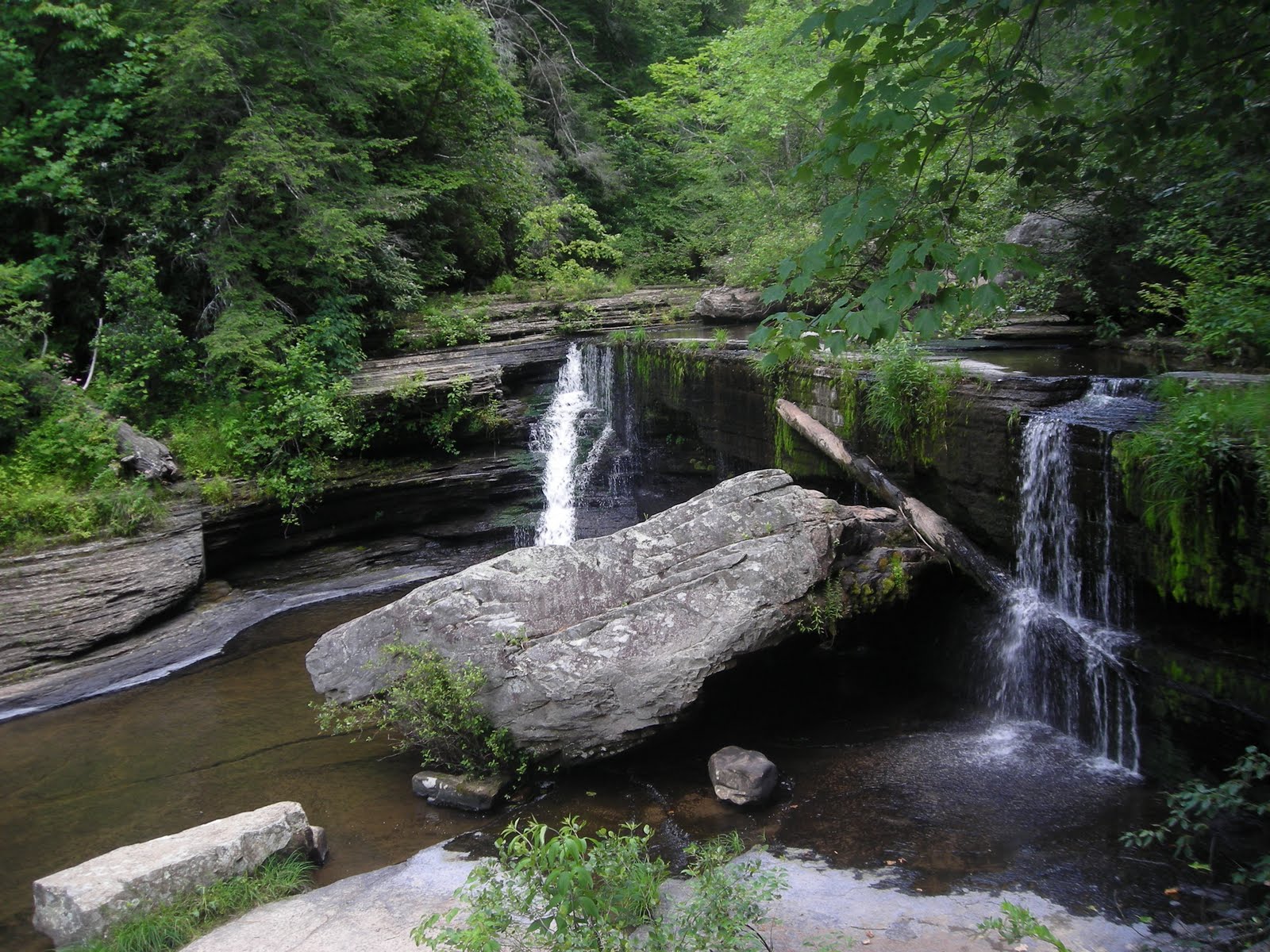
I arrived not long before sunset, finding the cool spray of the falls totally necessary to counter the humidity of a warm season in the Georgia piedmont. (pictured at top) Then below the falls a little hiding space on the river's edge, with lots of rabbits and other wildlife running past me really made me want to stay.


http://www.gastateparks.org/HighFall

INDIAN SPRINGS

A little further from I-75 is middle Georgia's "Indian Springs," which was also a Creek settlement, then incorporated as a town by the whites, and the land around the spring and the two streams that also join there was bought by the state in 1825 as Georgia's original state park. Recognizing the importance of preserving the spring, the state has resisted offers from private companies to sell the land (for bottling/selling water, for example) because of its renowned healing properties (similar to other cases around the world of the known healing properties of spring water, and the rise and fall of the health resort industry boom in the 20th century).


The Spring House - built by the CCC in the 1930's

The first person to capitalize on the springs' resort potential, ironically, was Creek Chief William McIntosh (the park's lake is named after him). He signed two fateful Treaties of Indian Springs here with the Georgia government; the first in 1821 gave him property of this land, where he built his second plantation and a hotel. It must not have been good enough, because in 1825, he caved in to the whites' quest for the land and signed the second treaty, giving these springs, the Towaliga river and falls, the Ocmulgee basin/Macon, and the area that would become the city of Atlanta (up to the Chattahoochee), including the very spot I am sitting in right now writing this.

I was almost out of water when I arrived at the park, and there were several travelers from Macon and Atlanta who regularly come here with empty jugs and take advantage of the forever free flowing fresh water. The water smells so good here, it smells like life. Not like a truckstop sink or cooler, or surrounded by a ritzy resort.
Thank you, state of Georgia, for preserving this spot!

http://www.gastateparks.org/IndianSprings

Thursday, April 15, 2010

go forth into the waterfall


GO FORTH INTO THE WATERFALL:
PISGAH and DUPONT forests, on APRIL afternoons


Jessica Powell and Brian Goforth want to bathe in a waterfall as a wedding ritual. Her dress will not just sit in the closet for years after their wedding, wearable but unworn; she will let the water and the rocks rip the dress into a mess of memories. And they will keep the torn dress and the moment. They're just shopping for waterfalls, now.

As I have mentioned, there is a long cluster of waterfalls around the tri-state meeting point of Georgia, North Carolina, and South Carolina, along a long escarpment where the Blue Ridge mountains meets the Piedmont foothills.
Really, there are so many to see, you could spend a four day trip here just visiting waterfalls starting around Tallulah Gorge in Georgia (see "Tallulah" two chapters below) moving up through Brevard, NC. Actually Transylvania County/Brevard calls itself "land of waterfalls."

In the quick warmth of one April Asheville afternoon, I sought a waterfall or more to cool off by, and I was about an hour from the "land of waterfalls." So I arrived near Brevard, at the literal gateway to the Pisgah National Forest (Pisgah ranger district) and stopped at the first waterfall I came to, Looking Glass Falls.
Looking Glass, popular because of its height and majesty yet close roadside access, is where I met Jessica and Brian (pictured at LGF). Their wedding is in July in a town nearby, so they are scouting for the perfect waterfall location,
starting here.
People are allowed to play in the pool below this falls, but the rocks just beneath the flume where Jessica's dress will tear are slippery and dangerous. So, they visit their next option, Moore's Cove Falls just a mile up highway 276, where I am also going.
Moore's Cove Falls (both pictures at the top) is about a half-mile hike from the
road: smaller, much more private, and you can go behind the waterfall and sit and stay dry! There are several other falls where you can do this, like "Dry Falls" about an hour further west, but this one is close and the afternoon sunlight glowed beautifully through the spill of water off the overhang. It was otherworldly, and so relaxingly cool...
Jessica and Brian seemed to like this place better for their post-wedding dress tearing, and I agree. As they left, I took off my shoes and hopped into the falling flume, standing sprite-like in the sunlight, hair getting wet, basking in the cool and warm of the moment.

After leaving the Pisgah forest district I drove to the also-recommended Dupont (NC) State Forest, a multi-use area of land near the NC/SC border. It's a watershed (Little River), plant and animal wildlife preserve previously owned by the Dupont company, and has suffered from erosion from Tropical Storm Ivan in 2004. There are also several major waterfalls on the premises, including four on the Little River. Before sunset, I was able to visit High Falls...

Triple Falls...


....and Hooker Falls, featured in the film "The Last of the Mohicans."


By now, the sun was setting and the air was already getting cool again.
Looking westward to Brevard and the valley, I pranced away. Hope and safety for a happy couple standing faces to the mist...

For more about Dupont SF:
http://www.dupontforest.com/ecology.asp


For Pisgah NF and those falls:
http://www.pisgahforest.com/photogallery/waterfalls/index.htm

Friday, October 9, 2009

Standing Peachtree / Osage-Orange

ADVENTURES IN ATLANTA: Standing Peachtree

Today I tried to visit the place where Peachtree Creek flows into Chattahoochee River, off Marietta Blvd in West Atlanta/Buckhead next to the giant City of Atlanta water treatment plant.
This is the origin of the city, occupied by Creek Indians and visited by white traders until 1814, when Fort Peachtree was built by the military to drive the Creeks out.
The Creek village was known as "Standing Peachtree" due to a single tree (peach or not) on top of a hill or mound overlooking the river. Peachtree Street and all of its descendants are, of course, a reference to this.
Supposedly Fort Peachtree can be visited by the public, but when I drove across the bridge on Ridgewood Drive, I only found a large fenced-off forested area with signs saying "City of Atlanta: Keep Out." No park, no visible fort or even a reference to a public attraction...just a historical marker further on Ridgewood Drive talking about the fort as if it is covered by homes and a neighborhood.
I have a hunch that the Fort, and the settlement remains, and the river confluence, are all behind that fence with the "Keep Out" sign, and that the water treatment plant and overflow facility has taken over the site, deeming it "unsafe" for people to access.
This is a shame, if so - another example of natural and cultural history being carelessly covered in the name of development and industry, not to mention an implication of environmental destruction of the River basin...which, upon research, has been argued multiple times by the Upper Chattahoochee Riverkeeper organization.

Oh, a trip into nature in my beautiful city of Atlanta.

OSAGE-ORANGE REDEMPTION

Luckily, as I drove back through Buckhead following Peachtree Creek upstream, urban park areas began, as the "Atlanta Memorial Park." At one point along the Creek, by Northside Drive, a few Osage-Orange trees grow (and are identified). They have this amazing bumpy large green fruit! The trees are thick and twisty with brown and orange bark. These trees are common in the Mississippi Valley and in the prairies but rare here. I wish I had brought my camera, but I'm going back soon.
Meanwhile, I am going to start referring to Northside Drive as "Osage-Orange Avenue."

-Arianna, R.F.

Tuesday, September 22, 2009

A Turn to Tennessee, A Fiery Gizzard in the Rain

Imagine being the first autumn leaf at the bottom of these falls.


ttttennesssseee parks I visited last weekend, for the second time - Red Clay Council Ground in April was the first, the last gathering place for the Cherokee before the Trail of Tears was begun - and it was raining but that didn't stop me. I was standing in North Chickamauga River in a gorge with fog covering the peaks above and the water was warm.


Faith is a flat-iron in the valley rain. Hope is a blow dryer.
Loneliness is a soggy daisy in Soddy-Daisy. And contentment is this spider on its riverside rock.


After this I was led up Monteagle Mountain, the truckers' favorite hill to hate, and at the top a mountain man suggested this white-dressed witchy woman wander to Grundy Forest and the Fiery Gizzard. One of the South Cumberland Plateau State Parks between Chattanooga and Nashville, on Scenic Hwy 41, it was like a mist tent going down the trail to the creek but I wasn't the only one out here in the rain.


Some waterfalls.....
Dog Hole (or Blue Hole)


School Run


Foster Falls


and thennn....