Showing posts with label nature. Show all posts

Friday, October 22, 2010

miles and miles in black ballet flats: my first autumn day in Forest Park, Portland

...MILEPOST 17 or SO...

on a fallen tree in Forest Park
dewy mush fungus white pod things and longhair moss, green shag carpet and the hollies and ferns along the halloway
Clouds cover today for the first time since I arrived in town
Will today be the beginning of the rain?
I've heard people talk that it is coming, soon
The low constant roar of trucks on Saint Helens Road and Saint Johns Bridge
disappear and slence for a moment - was that the train? I'm deep in a forest.
Wait. the MAX goes through a tunnel deep beneath this Tualatin hill.

...Now I hear voices, human voices, sounds like a radio or phone. (?!)
I'm just taking pictures of mushrooms here, up there glistening in the sun.
what would the deer that ran by say?
I've walked to get here a long way.
Miles and miles in Ballet Flats.
I'm the guard of the fallen trees -
sword as splinter to the tramps
who pass though the moss house of faerys


Miles and Miles in ballet flats.
I walk this far to show you that
I can - alone and guided by no man

Miles and miles in ballet flats
I seek to find you, sister dear

whether playa or Under Ice
I feeel your heart pumping so near

For Faith is still a Flatiron, and I mean the mountain,
just before a quick storm
and Hope is Saint John, waiting for the bus over his bridge
in the rain again at 5 pm

and then there's Other sister, you,
sunning yourself on a piece of the rock you found at the base of an Altar that
forms a Bridge
connecting the faerys from here but I've heard youmay fall -
no you'll swing like Wallenda on Tallulah but will NOT fall
if you are walking in Black Ballet Flats!!!

LEAF ERIKSEN
Among the firs which are not really firs, they look more like ferns (cause they're Western Red Cedars)
Ballet Slippers are a gift from the faerys, made by the gnomes.
Oh my, it's getting cloudy, if these shoes get wet, I have to find the Orc to make me a towel in his mill by the river below

(it's polluting the river, but he's a holdout from the old days,
he has a boat and he lives in Oswego and has several Beavers as Maids)

About the park

Thursday, September 9, 2010

'Econfina Spring to swim in, so I just jumped in the Crick: North Bay County, FL (Yellow)


Heey y'all PC beechers! So the main watersource feeder of Panama City, Econfina Creek, is also lined with natural springs on its upper section. Again, most of 'em are only accessible by canoe, and the public spring (Pitt) was closed for renovations when I tried to visit it. Near the closed park and the FL-20 bridge is a canoe launch, fairly popular with locals who suggested I just swim in the river. So I did - jumped in the yellow-toned clear sandy water and waded/dog-paddled up the current to the spring exit and back down, and it was exactly as desired - wild yet calm, safe yet with solitude, each river a distinctly unique experience and the greatest gift to the towns they serve. From PC: go up FL-77, turn right at Hwy 20, go a few miles till you see the sign for Econfina Creek Canoe Livery, then it's at both sides of the bridge, on the left. As they say, "nothin' could be finer than the econfina!"

Monday, September 6, 2010

that sweet sweet emerald Chipola: Marianna, FL (Green)


Last year when touring Florida's natural springs, I just barely mentioned the Chipola River, going underground on the escarpment in Florida Caverns State Park. Well, we come to find out it is fed by almost 65 springs, from its initial rise on the Alabama/Florida border through Marianna, its emerald-toned water and holy limestone banks winding along, often only a mile from civilization but feeling far removed from it. Spring Creek (aka Jackson Blue Springs) is its largest tributary, and it contains several springs, mostly only accessible via water travel.
You can get in at Spring Creek county (Jackson) Park off US-90 just outside of town, by the Chipola Greenway from a dirt road off FL-73 between downtown and the bridge over I-10, or one of several boat landings upstream or downstream from these. The upper Chipola feels oh so magical, sweet, and pure! but closer to the Dead Lakes and its swampy merges with the Apalachicola it turns into a "regular" dark coastal river.

HELL is full of Cypress Trees and Lilypads (Brown and occasionally Red)


when I talked last year about the wildness of natural Florida I missed a few places...namely that east bank of the mostly undeveloped Apalachicola River, with the Apalachicola National Forest, a town called Sumatra, and the most unwelcoming-named parkland ever, Tate's Hell State Forest!
When we first arrived the swamp was strangely silent, and the complex network of gravel roads was very confusing with occasional mudholes. But after a night camping under bright moonlight with a shore breeze, we found the forest teeming with wildlife- deer, an eagle, owls just after dawn, however they make themselves scarce so you won't see them unless you're on foot in the woods. Dwarf- cypress trees stand among the pines in some swampier areas, and there are interesting finds in others...and a fountain spring by our campsite, near the slow, dark waters of the New River..

for the story of Cebe Tate and the origin of the forest name...http://www.tateshell.com/ and for official park information...http://www.fl-dof.com/state_forests/tates_hell.html

Wednesday, July 14, 2010

SAVAGE GULF STATE NATURAL AREA – BEERSHEBA SPRINGS, TENNESSEE


Savage Gulf and other gulfs, midsummer with the faeries and country legends on the plateau, “living proof” of sharks...or muskies! Bodysurfin' the Appalachians, swimmin' holes and movin' stars.

It began at Stone Door Camping Area, where we arrived just before sunset, enough time to set up our tent and walk over to small Laurel Falls behind the ranger office. I had been to Cumberland Plateau before, knowing in advance about the gulfs, the bowl-shaped pools at the bottom of waterfalls, that almost define this area of Tennessee. Contrast this with the sharp cliffs of the Blue Ridge (see “go forth into the waterfall”) and how these falls are more kind to swimmers and divers.


greeter falls


There are several gulfs, falls, and sinks spread across the park, a huge area of the west face of the Plateau, but Greeter Falls is the most well-known to locals since it's so easily reachable from its parking lot. By the time we reached the lower falls next morning, it was already hot and a group of teenage boys were swimming and diving. Nature's bath, clear and so cold! Since the boys were so loud, some fish swam to us as we bathed in the sunlight.

The campground? Remote and dark yet not far from the parking lot, with pit toilets close and flush toilets still not too far. And fire pits with plenty of already-cut wood around, perfect for sister fire-breather to keep a healthy flame for hours while white-tailed songs we played into the late night. The wood turned out filled with termites, though, suffering for our solstice fun as they were engulfed in the flames.


Fun Fact: The park's Stone Door rock was used for a climactic moment in the film “Living Proof” about Hank Williams, Jr.

If you go, camping is free on all parts of the park but requires a permit. Also, it is said that many poisonous snakes (rattlesnakes, copperheads) call the park home, but we didn't find any.

for more about Savage Gulf:
http://www.tennessee.gov/environment/na/natareas/savage/


Thursday, April 15, 2010

go forth into the waterfall


GO FORTH INTO THE WATERFALL:
PISGAH and DUPONT forests, on APRIL afternoons


Jessica Powell and Brian Goforth want to bathe in a waterfall as a wedding ritual. Her dress will not just sit in the closet for years after their wedding, wearable but unworn; she will let the water and the rocks rip the dress into a mess of memories. And they will keep the torn dress and the moment. They're just shopping for waterfalls, now.

As I have mentioned, there is a long cluster of waterfalls around the tri-state meeting point of Georgia, North Carolina, and South Carolina, along a long escarpment where the Blue Ridge mountains meets the Piedmont foothills.
Really, there are so many to see, you could spend a four day trip here just visiting waterfalls starting around Tallulah Gorge in Georgia (see "Tallulah" two chapters below) moving up through Brevard, NC. Actually Transylvania County/Brevard calls itself "land of waterfalls."

In the quick warmth of one April Asheville afternoon, I sought a waterfall or more to cool off by, and I was about an hour from the "land of waterfalls." So I arrived near Brevard, at the literal gateway to the Pisgah National Forest (Pisgah ranger district) and stopped at the first waterfall I came to, Looking Glass Falls.
Looking Glass, popular because of its height and majesty yet close roadside access, is where I met Jessica and Brian (pictured at LGF). Their wedding is in July in a town nearby, so they are scouting for the perfect waterfall location,
starting here.
People are allowed to play in the pool below this falls, but the rocks just beneath the flume where Jessica's dress will tear are slippery and dangerous. So, they visit their next option, Moore's Cove Falls just a mile up highway 276, where I am also going.
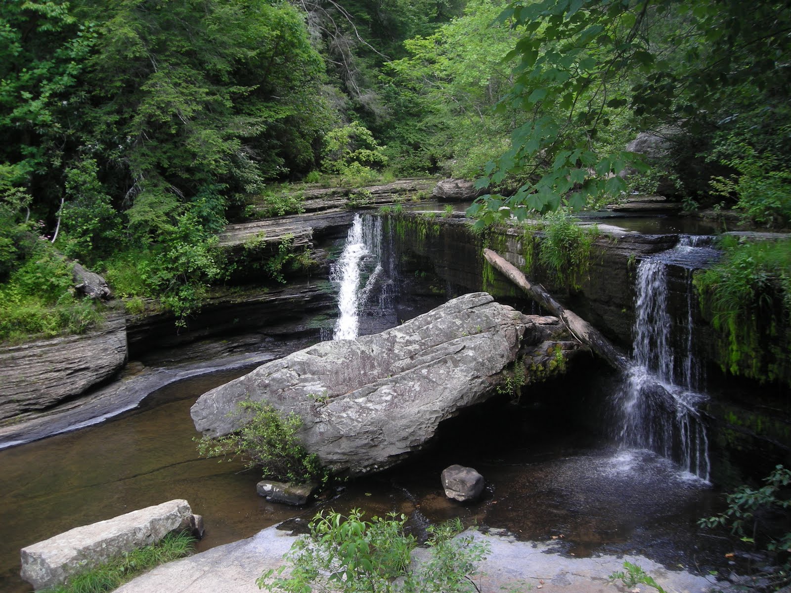
Moore's Cove Falls (both pictures at the top) is about a half-mile hike from the
road: smaller, much more private, and you can go behind the waterfall and sit and stay dry! There are several other falls where you can do this, like "Dry Falls" about an hour further west, but this one is close and the afternoon sunlight glowed beautifully through the spill of water off the overhang. It was otherworldly, and so relaxingly cool...
Jessica and Brian seemed to like this place better for their post-wedding dress tearing, and I agree. As they left, I took off my shoes and hopped into the falling flume, standing sprite-like in the sunlight, hair getting wet, basking in the cool and warm of the moment.

After leaving the Pisgah forest district I drove to the also-recommended Dupont (NC) State Forest, a multi-use area of land near the NC/SC border. It's a watershed (Little River), plant and animal wildlife preserve previously owned by the Dupont company, and has suffered from erosion from Tropical Storm Ivan in 2004. There are also several major waterfalls on the premises, including four on the Little River. Before sunset, I was able to visit High Falls...

Triple Falls...


....and Hooker Falls, featured in the film "The Last of the Mohicans."


By now, the sun was setting and the air was already getting cool again.
Looking westward to Brevard and the valley, I pranced away. Hope and safety for a happy couple standing faces to the mist...

For more about Dupont SF:
http://www.dupontforest.com/ecology.asp


For Pisgah NF and those falls:
http://www.pisgahforest.com/photogallery/waterfalls/index.htm

Tuesday, March 9, 2010

from a Broken Bridge, Sweetwater has never seemed sweeter


I've been thinking about ruins lately...
A trip to Sweetwater Creek State Park on the cusp of spring, a tear drop shed as I entered for hearing that amazing sound of rushing water not fifteen minutes from
my home. And though it's warm, the trees are still bare, so there are so many clear views of the river all along.
The trail to the mill is well-traveled, so this time I chose to walk upstream, in solitude except for occasional joggers and dogs fo
llowed by tag-along men. I'd heard people talk about a bridge here, but I didn't see one, surprising given the lack of leaves. Then around a bend and under a mess of debris and fallen trees:


"It was September's flood that broke this bridge...
the hard work of 15 years by the Army Corps of Engineers!
a mass of green steel beams torn and thrown into the stream.
no human touch, only the hand of nature."
A jogger tells me this as he passes the ruin for the first time. It's going to change his route, he was expecting to cross as many others do.
Who would have thought, from a creek so Sweet, renewing itself again?

This could be a microcosm of the experience for those who lived through Hurricane Katrina, like my friend from Mississippi with whom I shared this story.

I sat on the concrete ledge which once was the bridge for a while, then as the sun was going down I walked down to the Mill area. Later in the day it's not so crowded and the rushing water over the shoals make for the best river experience
in metro Atlanta! There is some boardwalk and trail damage too, down here, where volunteers have been working to clean some of this up.
Here's a beautiful view of the river through the mill you can only see when the trees are bare:


I love this park and I will come here again as soon as I can!

For more information about Sweetwater, check out http://www.gastateparks.org/Sweetwater


Saturday, February 13, 2010

Winter Update 1: Occoneechi Mountain State Natural Area, NC


While passing through central North Carolina (my home state) I wanted to stop and visit one of the newer state natural areas, one that had been designated since I lived there. Occoneechi "Mountain" on the headwaters of the Eno River, once a Saponi settlement and only 867 feet in altitude - but still the highest point along the I-85 corridor and eastward to the coast - is easy to find, tranquil, and beautiful on a cloudy winter afternoon.

Near the summit is a circle of stones, the best spot to view the northward valley when the trees are leafless. I met an interesting woman there. It was so peaceful and the almost-melted snow spotted across the whole monadnock. If you walk up the main summit trail, look to your right just before the old firetower!
Occoneechi Mountain is located just off of I-85 at the S. Churton St. exit, near Hillsborough, NC. For more information....visit http://www.ncparks.gov/Visit/parks/ocmo/main.php


Wednesday, November 18, 2009

"Desert-shore girl" music video - shows this week at AGIFF!

The video I produced for the song "Desert-shore Girl" will be showing at the Ava Gardner Independent Film Festival in Smithfield, NC this Friday (November 20)!

"Desert-shore Girl" (which I wrote and recorded with my band Found Objects of Desire) was inspired by Florida's parks, less-developed beaches, and natural springs.
Some of my photos and writing that accompany the video and experience are in earlier entries on this blog (September 2009).

Also, a video for "Meandering" - another Found Objects of Desire song, lensed/directed by my friend Athena Reel and featuring mountains in and around Asheville, NC - will show at the festival this weekend.

Here is the "Desert-shore girl" video for all to enjoy!!
Thanks to Kelly, the staff at Manatee and Wakulla Springs, Athena, Jamie, Ashes, and anyone else who helped out with this.

Wednesday, November 4, 2009

Autumn in North Georgia, Part 1: Deer Season


DEER SEASON
Fall 2009
Looking for that great salt-lick in the woods. All you silly hunters keep away!

All photography: zbilly (Billy Gilbert)
Custom deer dress by Hampton + Mascioli
Locations: Brasstown Bald (highest place in Georgia), Blood Mountain, Choestoe Valley


2009 Arianna Fawn

Friday, October 9, 2009

Standing Peachtree / Osage-Orange

ADVENTURES IN ATLANTA: Standing Peachtree

Today I tried to visit the place where Peachtree Creek flows into Chattahoochee River, off Marietta Blvd in West Atlanta/Buckhead next to the giant City of Atlanta water treatment plant.
This is the origin of the city, occupied by Creek Indians and visited by white traders until 1814, when Fort Peachtree was built by the military to drive the Creeks out.
The Creek village was known as "Standing Peachtree" due to a single tree (peach or not) on top of a hill or mound overlooking the river. Peachtree Street and all of its descendants are, of course, a reference to this.
Supposedly Fort Peachtree can be visited by the public, but when I drove across the bridge on Ridgewood Drive, I only found a large fenced-off forested area with signs saying "City of Atlanta: Keep Out." No park, no visible fort or even a reference to a public attraction...just a historical marker further on Ridgewood Drive talking about the fort as if it is covered by homes and a neighborhood.
I have a hunch that the Fort, and the settlement remains, and the river confluence, are all behind that fence with the "Keep Out" sign, and that the water treatment plant and overflow facility has taken over the site, deeming it "unsafe" for people to access.
This is a shame, if so - another example of natural and cultural history being carelessly covered in the name of development and industry, not to mention an implication of environmental destruction of the River basin...which, upon research, has been argued multiple times by the Upper Chattahoochee Riverkeeper organization.

Oh, a trip into nature in my beautiful city of Atlanta.

OSAGE-ORANGE REDEMPTION

Luckily, as I drove back through Buckhead following Peachtree Creek upstream, urban park areas began, as the "Atlanta Memorial Park." At one point along the Creek, by Northside Drive, a few Osage-Orange trees grow (and are identified). They have this amazing bumpy large green fruit! The trees are thick and twisty with brown and orange bark. These trees are common in the Mississippi Valley and in the prairies but rare here. I wish I had brought my camera, but I'm going back soon.
Meanwhile, I am going to start referring to Northside Drive as "Osage-Orange Avenue."

-Arianna, R.F.

Wednesday, September 17, 2008

intro

Welcome to my blog! I'm a multimedia artist based in Atlanta..I play music as "found objects of desire" and have recently become a wardrobe stylist.
Thrift and vintage stores have long been an interest and inspiration for me. I still feel guided, occasionally limited, by my indie film/theatre background & nature spirituality.
(model: Mya Hassan photo: zbilly 2007)
Somewhere along the way, though, I got lost in the fashion forest and I am not sure where the edge is...