Wednesday, November 18, 2009
Osage-Orange 3: home again
HOME AGAIN
The Osage-orange tree's fruit which I discovered at Peachtree Creek in October and seemed to symbolize Harvest 2009 was taken back to the park. Rotten contentment.
Who knew it would inspire a song?
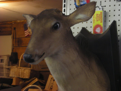
That - and the "Apples and Fireworks" store up in thar' hills with that singin' deer bust...
MAKE A WISH
when the great seamstress falls down on her knees
and spills all the apples she picked off the trees, the fireworks she bought
that she holds in her arms like a baby ignite and make light in the night
(and the appppples are rotten but they look white)
Down from the mountain she drove past a store
selling fruits and explosives and not much more
highway 25 dressed in a coat of orange grandfather's burgundy boots carry me
softly with his memory (it's been a year already)
and midwestern trees with an orange bark grow discreetly in an Atlanta suburban park
with a creek named after a fruit whose trees in this area have all been cut down
and no longer grow...
...and the girl in the band with a banjo in hand
drives an arrow-shaped van down the mountain
blues from a bow, it lands by a deer in the snow
"this is your chance," she says, "now let's go."
make a wish, make a wish, make a wish and place your fruit in the spiral
make a wish, make a wish, make a wish and hope that you'll be back tomorrow
won't you take me to a place to a far away place with nothing to remind me and I hope no one will find me but the gods in the garden and pay for my lodging cause I need recharging and ground me out like a telephone pole coming down from a mountaintop i am psyche so i was told bored of gourds and tired of boys
sunset
fawn rising
(if you have any questions about all of this, feel free to ask away!...)
"Desert-shore girl" music video - shows this week at AGIFF!
The video I produced for the song "Desert-shore Girl" will be showing at the Ava Gardner Independent Film Festival in Smithfield, NC this Friday (November 20)!
"Desert-shore Girl" (which I wrote and recorded with my band Found Objects of Desire) was inspired by Florida's parks, less-developed beaches, and natural springs.
Some of my photos and writing that accompany the video and experience are in earlier entries on this blog (September 2009).
Also, a video for "Meandering" - another Found Objects of Desire song, lensed/directed by my friend Athena Reel and featuring mountains in and around Asheville, NC - will show at the festival this weekend.
Here is the "Desert-shore girl" video for all to enjoy!!
Thanks to Kelly, the staff at Manatee and Wakulla Springs, Athena, Jamie, Ashes, and anyone else who helped out with this.
Sunday, November 15, 2009
Vogel in October / Leaf Watch GA
A little late, but....
Today is the final day of the Georgia State Parks' Autumn Leaf Watch contest.
(if you've taken photos of leaves at any of the state parks this fall)
Post your photos on Flickr - find out more at
http://www.gastateparks.org/LeafWatch/
VOGEL STATE PARK, GA - OCTOBER 2009
Vogel is the second-oldest Georgia State Park, developed by the CCC and a notable mountain tourist destination in the 1940's and 1950's. It's on the Nottelee River side of Blood Mountain, centered around the little Lake Trahlyta - though the park's several miles away from Trahlyta's grave/home/spring. There's a place to swim in the summer, but the waterfall below is really picturesque and only a short walk away!
photography by zbilly (Billy Gilbert)
wardrobe = "shamanic secretary"
special appearance by Petey the Puppy
2009 Arianna Fawn
RIP granddad
Wednesday, November 4, 2009
Autumn in North Georgia, Part 1: Deer Season
DEER SEASON
Fall 2009
Looking for that great salt-lick in the woods. All you silly hunters keep away!
All photography: zbilly (Billy Gilbert)
Custom deer dress by Hampton + Mascioli
Locations: Brasstown Bald (highest place in Georgia), Blood Mountain, Choestoe Valley
2009 Arianna Fawn
Wednesday, October 21, 2009
Osage-Orange 2: update
I returned to Peachtree Creek yesterday, and here is a photo of the Osage-Orange fruit with its majestic tree in the background:
The fruits:
The bark:
And here is a photo of the historic Standing Peachtree site, from Ridgewood Road:
I called the number on the Fort Peachtree website:
http://www.buckhead.net/history/fort-peachtree/index.html
but no answer.
Alas,
Arianna R.F.
10/21/09
The fruits:
The bark:
And here is a photo of the historic Standing Peachtree site, from Ridgewood Road:
I called the number on the Fort Peachtree website:
http://www.buckhead.net/history/fort-peachtree/index.html
but no answer.
Alas,
Arianna R.F.
10/21/09
Friday, October 9, 2009
Standing Peachtree / Osage-Orange
ADVENTURES IN ATLANTA: Standing Peachtree
Today I tried to visit the place where Peachtree Creek flows into Chattahoochee River, off Marietta Blvd in West Atlanta/Buckhead next to the giant City of Atlanta water treatment plant.
This is the origin of the city, occupied by Creek Indians and visited by white traders until 1814, when Fort Peachtree was built by the military to drive the Creeks out.
The Creek village was known as "Standing Peachtree" due to a single tree (peach or not) on top of a hill or mound overlooking the river. Peachtree Street and all of its descendants are, of course, a reference to this.
Supposedly Fort Peachtree can be visited by the public, but when I drove across the bridge on Ridgewood Drive, I only found a large fenced-off forested area with signs saying "City of Atlanta: Keep Out." No park, no visible fort or even a reference to a public attraction...just a historical marker further on Ridgewood Drive talking about the fort as if it is covered by homes and a neighborhood.
I have a hunch that the Fort, and the settlement remains, and the river confluence, are all behind that fence with the "Keep Out" sign, and that the water treatment plant and overflow facility has taken over the site, deeming it "unsafe" for people to access.
This is a shame, if so - another example of natural and cultural history being carelessly covered in the name of development and industry, not to mention an implication of environmental destruction of the River basin...which, upon research, has been argued multiple times by the Upper Chattahoochee Riverkeeper organization.
Oh, a trip into nature in my beautiful city of Atlanta.
OSAGE-ORANGE REDEMPTION
Luckily, as I drove back through Buckhead following Peachtree Creek upstream, urban park areas began, as the "Atlanta Memorial Park." At one point along the Creek, by Northside Drive, a few Osage-Orange trees grow (and are identified). They have this amazing bumpy large green fruit! The trees are thick and twisty with brown and orange bark. These trees are common in the Mississippi Valley and in the prairies but rare here. I wish I had brought my camera, but I'm going back soon.
Meanwhile, I am going to start referring to Northside Drive as "Osage-Orange Avenue."
-Arianna, R.F.
Tuesday, September 22, 2009
A Turn to Tennessee, A Fiery Gizzard in the Rain
Imagine being the first autumn leaf at the bottom of these falls.
ttttennesssseee parks I visited last weekend, for the second time - Red Clay Council Ground in April was the first, the last gathering place for the Cherokee before the Trail of Tears was begun - and it was raining but that didn't stop me. I was standing in North Chickamauga River in a gorge with fog covering the peaks above and the water was warm.
Faith is a flat-iron in the valley rain. Hope is a blow dryer. Loneliness is a soggy daisy in Soddy-Daisy. And contentment is this spider on its riverside rock.
After this I was led up Monteagle Mountain, the truckers' favorite hill to hate, and at the top a mountain man suggested this white-dressed witchy woman wander to Grundy Forest and the Fiery Gizzard. One of the South Cumberland Plateau State Parks between Chattanooga and Nashville, on Scenic Hwy 41, it was like a mist tent going down the trail to the creek but I wasn't the only one out here in the rain.
Some waterfalls.....
Dog Hole (or Blue Hole)
School Run
Foster Falls
and thennn....
Labels:
chattanooga,
cumberland,
fiery,
gizzard,
monteagle,
park,
rain,
tennessee,
waterfall
Georgia SaveMyStateParks Day is Sept 26
This Saturrrday, September 26, all Georgia State Parks are free admission! Visit them and support them amid funding cuts and keep them from having to be closed!
Visit www.savemystateparks.org for more info.
If you live in Atlanta, magnificent Sweetwater Creek park is to the west (assuming it's open considering this creek flooded last weekend). Red Top and Etowah Indian Mounds are to the northwest, by Lake Allatoona and Cartersville. Panola Mountain is to the southeast between Lithonia and Stockbridge.
(see below for photos and more about these)
I plan to be at Cloudland Canyon and its wild waterfall this weekend - it's on Lookout Mtn. near Chattanooga.
Thursday, September 17, 2009
Find your home, in the limestone
I DREAMT I DWELT IN LIMESTONE HALLS
Beside the swimming area at Wakulla Springs, the limestone floor drops to over one hundred feet below the surface.
And, for those divers who have seen these depth and not drowned, there is a cave that connects to the gulf, below the Wakulla River and below the old fort San Marcos de Apalache, below the soft earth along each side that holds WalMart and several country homes, and the river's two spooky bridges.
Some of the fish that have lived here have followed the current from as far as South Florida and the Keys, it's been Sead.
And of course, manatees like the underwater caves too.
"come to the surface, I'm dreaming of you."
About a hundred miles Northwest is Florida's only aboveground cavern open to the public, Florida Caverns State Park along the Chipola River near one of its hiding places, where this river had risen years ago and created bluffs, recalling the days of yore when most of Florida was still underwater and these caverns were along the shore.
MY LUCK the cavern tour was closed when I was there, but I still got to witness this exciting combination, the paradox where palmettos cover walls of rocks...
just beyond here is where the sweet Chipola burrows underground for a few miles.
dream on,
Arianna
Thursday, September 10, 2009
Florida Springs, Part 2: The (sur)Real Florida
There's a voice that says "just let yourself be..."
Is it a lady or is it a manatee?
You'll have to come down to the spring and see.
Mimimolotov the mullet seems to disagree:
"There's people up there and I have to jump up and see,
and never mind the fishermen down at Steinhatchee."
(but it does sound like an exciting industry)
There are places where the humans don't really get to go
and that's ok with us as long as they know
sometimes we do have to remind them, though
(and sometimes they have to build fences to make sure no boats try to slip through)
my country home,
my lovely, never lonely,
Black Lagoon
where algae and branches are walkways
over floors I don't even know how deep
All photos at Wakulla Springs State Park (Wakulla, FL)
except #2 of the mullet at Manatee Springs
and the above photo is at Sally Ward Spring inside Wakulla Park.
Wednesday, September 9, 2009
Florida Springs, part 1
Florida is a quagmire.
(in more than one sense)
A watery, swampy semitropical land with wild variations of plant and animal life, some undeveloped and seemingly undevelopable, yet somehow overdeveloped in the names of Tourism and the Conquest of Paradise.
Aside from beaches (and family), Florida seemed not so interesting to me when I was young, because what I got to see was mostly theme parks and tourist attractions. Entering adulthood, and leaving a horrible high-school Disney trip, I'd never been to the "Real Florida" - as the Florida State Park system slogan goes - and so in 2006, I decided to move there!
I lived for a spring and summer on the Gulf Coast, along the panhandle by Panama City in a pastoral one-stoplight town. Every day nature passed me an element of inspiration. Oyster shells clanking, cypress reflecting, sitting tranquil over waters unsafe for swimming humans.
In summer 2009, I return again...
FLORIDA'S SPRINGS
www.floridasprings.org
There are hundreds of natural springs in Florida, mostly along the Gulf side where groundwater meets limestone and sinkholes and underwater caves form.
I visited, and swam in, several: Fanning, Manatee, Wekiwa, Wakulla.
The smell of living creatures in the clear water, the yellows, blues, and greens - are a sensual Fountain of Youth that can not, and will not, allow itself to be paved over.
Photos 1-3 are from Manatee Springs near Chiefland, FL, and the photo on the right is from Wekiwa, on the edge of Orlando.
Tuesday, August 25, 2009
Sweet (water) Dreams in Sour Times - Georgia and Florida State Parks, Vol 2
there are places so close to the clank of the city and it feels like you're hours away, and the water flows fast and loud over a cusp of limestone you forgot was there, and it fills you with its peaceful and primal energy at a time when you're stuck in the muck of a slow sad summer.
Sweet(water) dreams are made of this.
(Lindsey sits on a rock below the mill ruin)
Sweetwater Creek State Park is a large park,
so it's easy to find a place for yourself, even along the river at its rapids. Several others have already written about this place from a historical perspective, and the story of the Mill and its destruction in the Civil War, and its skeletal ruin, is central to the park's notoriety. It is understood why the mill and its industry were here in the first place - the same wild energy that empowers ____ at so many waterfalls...
...not to mention a large lake just above the mill and rapids, and a forest full of wildlife, a mix of North Georgia and the Piedmont. I found some deer to be helpful guides when nearly lost on my first trip this month, while cute frogs and toads found Eelnyl, Linds, and I picnicking on the rocks this past weekend.
Both trips, I arrived melancholy, and left wired and inspired.
(and splattering my friends with Jungian slips about Rising Fawns and such, like a Pollock painting)
for more info on Sweetwater Creek State Park, Lithia Springs, GA:
http://www.gastateparks.org/net/content/go.aspx?s=80.0.0.5
-Arianna, R. F.
Sweet(water) dreams are made of this.
(Lindsey sits on a rock below the mill ruin)
Sweetwater Creek State Park is a large park,
so it's easy to find a place for yourself, even along the river at its rapids. Several others have already written about this place from a historical perspective, and the story of the Mill and its destruction in the Civil War, and its skeletal ruin, is central to the park's notoriety. It is understood why the mill and its industry were here in the first place - the same wild energy that empowers ____ at so many waterfalls...
... and the in-between-ness of the Brevard Fault that it crosses. The same that crosses Nickajack Creek at Ruff's Mill near Concord Rd. in Cobb County and probably Buford Dam on the Chattahoochee at Lake Lanier and Tallulah Gorge ninety miles northeast!
...not to mention a large lake just above the mill and rapids, and a forest full of wildlife, a mix of North Georgia and the Piedmont. I found some deer to be helpful guides when nearly lost on my first trip this month, while cute frogs and toads found Eelnyl, Linds, and I picnicking on the rocks this past weekend.
Both trips, I arrived melancholy, and left wired and inspired.
(and splattering my friends with Jungian slips about Rising Fawns and such, like a Pollock painting)
for more info on Sweetwater Creek State Park, Lithia Springs, GA:
http://www.gastateparks.org/net/content/go.aspx?s=80.0.0.5
-Arianna, R. F.
Tuesday, August 4, 2009
Georgia and Florida State Parks - part 1
Subscribe to:
Posts (Atom)